 As you can see, this is a graduated map detailed the world population by country in 2007. The darker it gets, the more people live there. You can see a cluster of pink in some areas, showing a cluster of cities. I wish I would have graduated the cities sizes a bit, just by color, because there are cities in some places that aren't on the same level as a Mexico City or Tokyo. The colors work well, and so does the legend. Yes, the legend blocked a little of the pacific ocean, along with some cities, but they aren't significant enough to have warranted coverage. the scale bar and scale key are bold enough and easy to read. Also, the compass rose is big and bold, however it's a bit overpowering for a world map. One more graduation might have been nice, but this is effective in itself. I'd give the map a 7 or 8 out of 10.
Showing posts with label USA. Show all posts
Showing posts with label USA. Show all posts
Tuesday, January 26, 2010
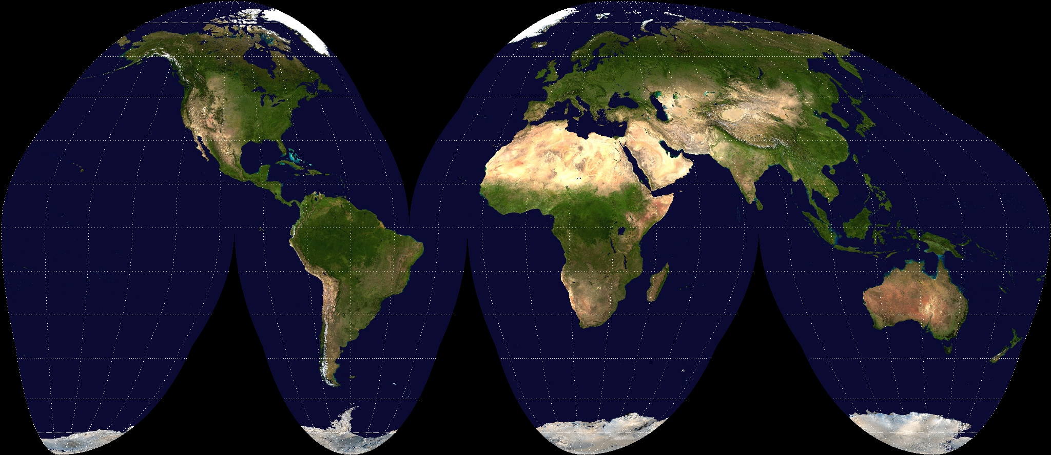
My First GIS Map, complete with Pros and Cons
As you can see, this is a graduated map detailed the world population by country in 2007. The darker it gets, the more people live there. You can see a cluster of pink in some areas, showing a cluster of cities. I wish I would have graduated the cities sizes a bit, just by color, because there are cities in some places that aren't on the same level as a Mexico City or Tokyo. The colors work well, and so does the legend. Yes, the legend blocked a little of the pacific ocean, along with some cities, but they aren't significant enough to have warranted coverage. the scale bar and scale key are bold enough and easy to read. Also, the compass rose is big and bold, however it's a bit overpowering for a world map. One more graduation might have been nice, but this is effective in itself. I'd give the map a 7 or 8 out of 10.
Thursday, January 21, 2010
Famous Contributors to Geography and Cartography
John Paul Goode (1862-1932) was one of the key American geographers early on. He spoke out against the “Evil Mercator” in 1908 at the meeting of the American Association of Geographers. He developed the Goode’s Homolosine projection that aggravated the world by not having America
Erwin Raisz (1893-1968) was one of the first cartography students in the United States, and was in charge of Harvard's map collection for twenty years and taught during that time. He is well-known for his intricately detailed pen-and-ink, hand-drawn maps. To this day, his family continues to publish his work through Raisz Landform Maps. He is also known for the first cartography textbook in English (General Cartography) in 1938.
George F. Jenks was a researcher from the University of Kansas who looked into the statistical importance of maps, and he discovered that contemporary maps at that time were significantly lacking. He wanted to teach simple map-drafting and getting back to the basics to ensure that future cartographers produced quality work after the so-called "golden age" in World War II that brought cartography out as a real discipline. He also pushed for new inks and techniques that would better show our world.
Waldo Tobler (born 1930) is an influential geographer and cartographer that developed the first law of geography: "Everything is related to everything else, but near things are more related than distant things." It is related to to Newton's Law of Universal Gravitation. It lead to the creation and still influences geostatistics. He currently teaches at UC-Santa Barbara, and more information can be found about him here.
Famous Universities that Furthered the Study:
- University of Wisconsin
- University of Kansas
- University of Washington
- University of South Carolina
Subscribe to:
Posts (Atom)


