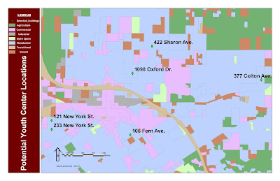
As you can see, this is a map developed with ArcGIS that is detailing the potential youth center locations in the area. I changed the font and color to make things easier to read as well. We cross-referenced census data of individuals considered youth (ages 5-17) versus vacant and available buildings. By combining layers and cross-referencing, these six locations are the best-suited and most-effective locations for youth centers.


No comments:
Post a Comment